
Largo Neighbor Records by Block
A block search is strongest when each source has a narrow purpose. The parcel viewer defines the lots around a chosen point. Property cards give owner and land details. The radius tool exports nearby parcels. Largo's municipal layers show whether those lots fall inside the city. Voter self-service is not a public block browser, and community boundaries are not resident lists.
| Source | What It Shows About a Block | Access |
|---|---|---|
| PCPA Parcel Viewer | Parcel shapes, surrounding lots, owner and address links | Free interactive map |
| Property Appraiser roll | Owner, site address, mailing address, legal description | Free Quick Search |
| Parcel-radius list | Owners and selected site or mailing addresses within a distance | Free PDF or Excel export |
| Largo and Pinellas GIS | Road, parcel, city-limit and neighborhood geography | Free public layers |
| Voter status system | A person's own status, precinct and districts | Identity-gated lookup |
Property ownership is public evidence of title, not a census of occupants. A homestead marker and matching site and mailing addresses may support owner occupancy, but neither identifies all adults, children, relatives, or other people at a home. Treat every owner name as a parcel fact. If the goal is to meet Largo neighbors, direct and respectful contact or a public civic event is more current than inferring a household from unrelated rolls.
Export Largo Neighbor Parcels
The Pinellas Property Appraiser offers a first-party radius list based on distance from a subject parcel boundary. It accepts distances up to 5,280 feet and can produce a label PDF or spreadsheet. Choose between mailing address and site address output. That choice changes what the export means: a mailing list follows where owners receive mail, while a site list follows the physical parcels around the subject property.
Open the official radius-list instructions before using the captured interface below. The instructions explain the output choices and keep a block project grounded in parcel data.
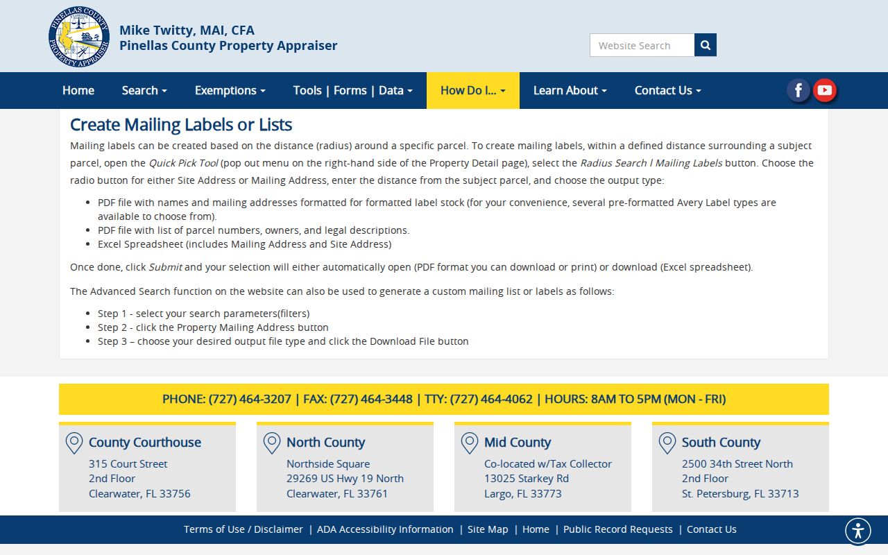
Start with a small distance that fits the immediate block. A one-mile export can cross major roads, subdivisions, and city boundaries. Review the result on the map rather than trusting row order.
Largo Neighbor Address Types
The site address locates the land. The mailing address is where the owner receives property correspondence. They may match, but a mismatch can reflect an absentee owner, a business address, a post office box, or another ordinary arrangement. It cannot identify a renter or prove that a house is vacant.
The live Pinellas radius example shows the site-or-mailing choice and export fields. The captured screen below makes that distinction visible before any nearby-owner list is created.
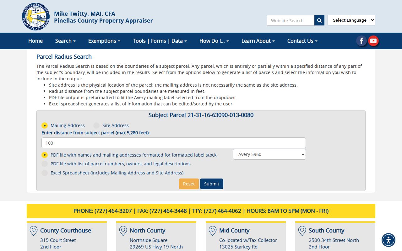
Key limit. Matching site and mailing addresses can support an owner-occupancy inference, but they never reveal a full household.
Map Largo Neighbors by Parcel
House-number order can be misleading near a boundary road or irregular subdivision. Define the block spatially. Start at the known parcel, click each touching or nearby parcel, and keep both sides of the road in view. The parcel layer supplies the shape; the property record supplies the owner data.
- Locate the subject address in the Pinellas parcel viewer and confirm the parcel ID.
- Click adjacent parcels in a consistent clockwise order. Record each parcel ID and site address.
- Open each property card for the owner, mailing address, legal description, and homestead clues.
- Add road and municipal-boundary layers. Remove parcels that only appear close because the search crossed a barrier.
- Use the radius export for a checked list, then reconcile it against the mapped block.
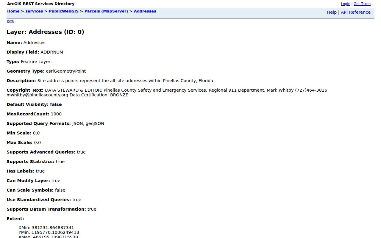
The Pinellas parcel GIS layer is the official spatial base shown in the image below. It helps keep nearby owners tied to actual parcel boundaries.
For an entire named road instead of the immediate area, use the Largo street directory workflow. That broader search follows address records along the full street.
Largo Neighbor Boundaries
A Largo mailing address does not guarantee that a parcel lies inside Largo's municipal jurisdiction. Nearby parcels can be split between the city and unincorporated Pinellas County. This affects which permit portal, code system, and local office should hold a record.
The Pinellas Enterprise GIS catalog brings parcel, historic aerial, and public map tools together. The captured catalog below is a practical fallback when a single viewer lacks the boundary or aerial layer needed for a block.
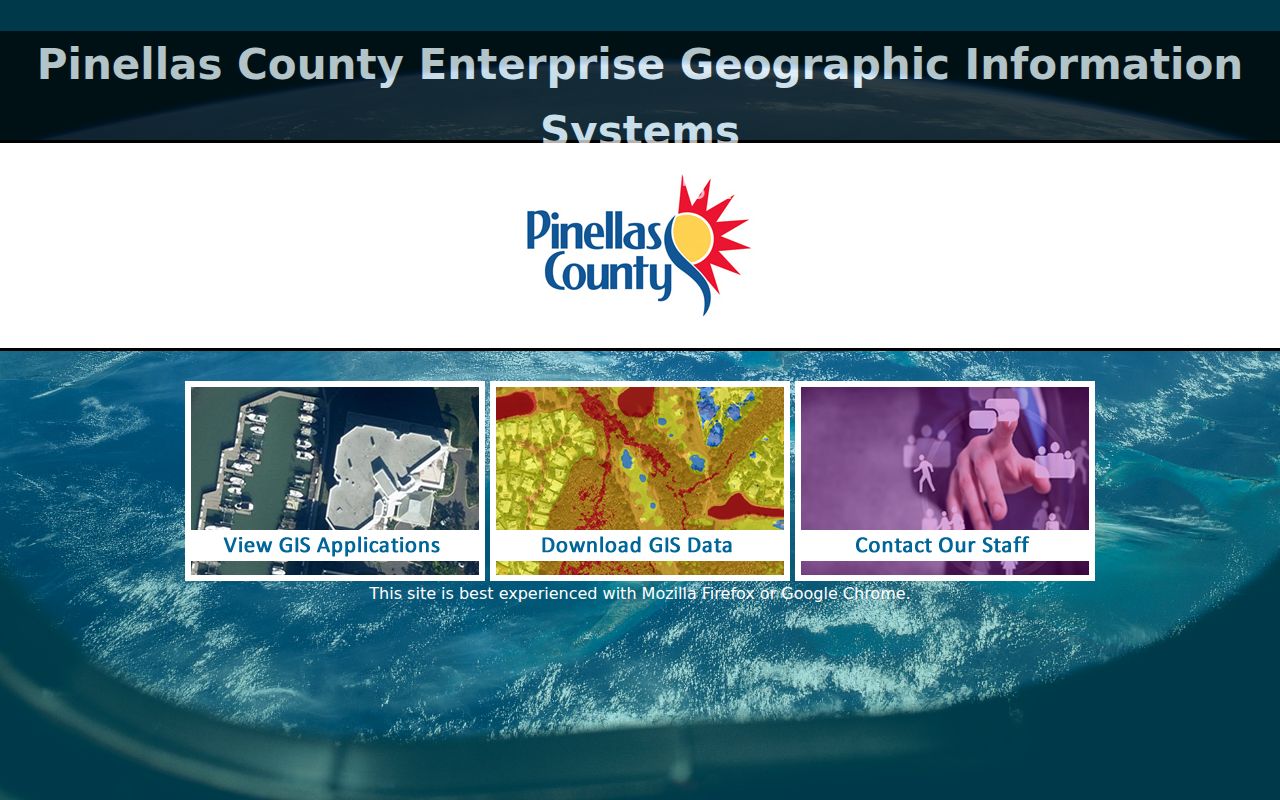
Community or neighborhood polygons also represent geography, not membership. A named area may help frame the search, but it does not create a public roster of Largo neighbors.
Largo Neighbor Address Points
Largo's municipal GIS carries address points with address, ZIP, emergency-service, and parcel components. An address point can help locate a structure when the parcel polygon is large, irregular, or shared. It does not supply a resident name. Join the point to the parcel, then open the official property card for the owner record.
Road centerlines and parcel edges answer different questions. A centerline defines the mapped road path; the parcel layer defines the land beside it. On a curved street or corner lot, the closest house number may not share a boundary with the subject parcel. Click the geometry rather than assuming adjacency from numbering.
Emergency-service and ZIP attributes also should not be read as municipal membership. Compare the city-limit layer when a postal Largo block reaches unincorporated Pinellas. That check directs permit or code questions to the correct custodian.
Largo Neighbor Voter Limits
Florida voter-registration records are generally public under state law, but the Pinellas online voter tool is an identity-gated status lookup. It is designed to confirm a person's registration, precinct, and districts. It is not an open map or street browser for compiling Largo neighbors.
A public-records request to the Supervisor of Elections remains subject to statutory protections. Social Security numbers, driver-license and state-ID numbers, signatures, and specified protected-voter details stay confidential. The right way to learn a block's precinct is to use district geography, not to infer a household from someone else's self-service screen.
When voter data is relevant to civic research, request only what the lawful purpose needs. Parcel and GIS sources remain the more direct tools for defining a block because they are keyed to land rather than private identity checks.
Largo Community Contacts
No authoritative current citywide HOA member directory was verified in the research. Do not substitute an old roster or a private social group. Use public civic contacts for their stated purpose and ask an association directly what it chooses to publish.
Largo GIS
Use address points, city limits, roads, ZIP boundaries, and other municipal layers to define the area.
Pinellas Enterprise GIS
Use county parcel tools, public applications, open data, and historic aerial resources.
Property Appraiser
Use property cards and radius output for public parcel and owner facts.
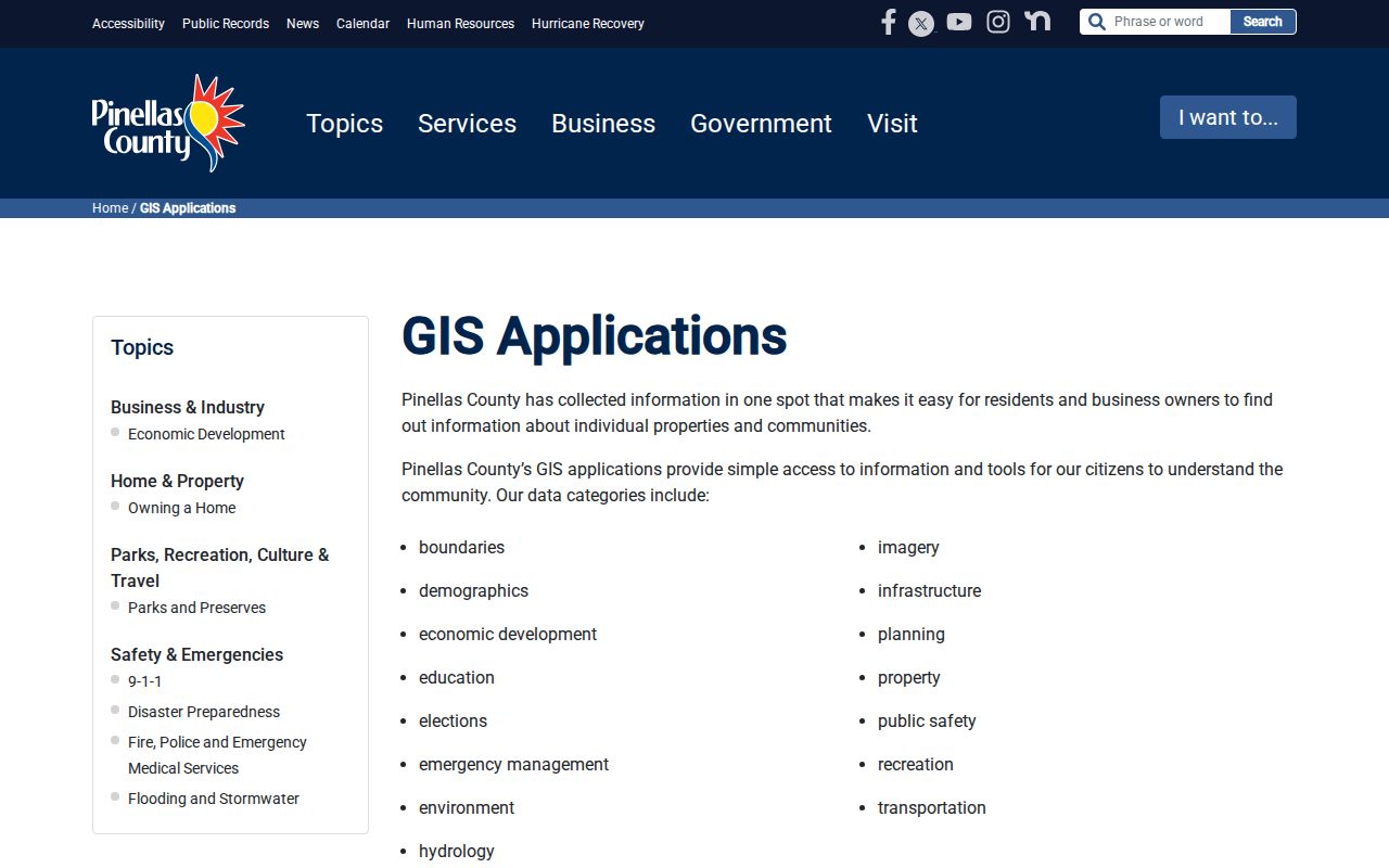
The Pinellas public GIS applications page is shown below. It provides an official route to current geographic tools without treating private community groups as public record keepers.
Official Largo Rolls Compared
Commercial neighbor tools often merge stale address histories, phone data, and inferred relatives. Official sources are narrower. They may take more work, but each field has a custodian and a defined meaning.
| Source type | Useful for | Main limit |
|---|---|---|
| Official parcel and GIS records | Owners, parcels, site addresses, legal geography | Do not identify every occupant |
| Voter self-service | Confirming one's own status, precinct, and districts | Not a block browser |
| Commercial compiled data | Possible leads only | Can be stale, merged, or wrong |
For Largo neighbors, verify land facts with the Property Appraiser and map layers. Do not convert a weak commercial hint into a claim about a person.
Privacy Limits for Largo Neighbors
Florida's public-records rules do not make every personal fact open. Social Security numbers, driver-license or state-ID numbers, voter signatures, and specified protected-voter information are confidential. Sealed, expunged, juvenile, adoption, and protected-address records are not ordinary lookup material. The Florida Attorney General's Address Confidentiality Program provides a substitute address and mail forwarding for eligible victims of domestic violence.
Utility details, delivery data, private association rosters, renters, and household members do not become public just because a parcel owner is visible. Respect the difference. A public owner name is not permission to watch a home or expose a protected person.
Lawful use. Use neighbor records for civic curiosity, respectful contact, reconnection, or personal safety awareness. Never stalk, harass, intimidate, or harm anyone.