
Nine Largo ZIP Intersections
The City of Largo address-point layer identifies nine ZIPs that intersect municipal jurisdiction. These counts describe address points, not residents, households, or postal customers. They are useful for seeing where city government and postal geography overlap. The research did not verify station names for each code, so the table reports mailing geography and the mapped city relationship rather than inventing post office assignments.
| ZIP | Largo Address Points | Mailing Area | Local Note |
|---|---|---|---|
| 33770 | 13,350 | Largo | Core and west-central area; postal reach extends beyond simple city assumptions. |
| 33771 | 18,399 | Largo | East and central Largo; largest city-address count in the query. |
| 33773 | 1,874 | Largo | South-central postal Largo with incorporated and unincorporated complexity. |
| 33774 | 6,540 | Largo | Southwest and west Largo. |
| 33778 | 3,718 | Largo | Northwest and west postal Largo; mixed municipal status. |
| 33756 | 2,813 | Clearwater | Thousands of points still have Largo municipal jurisdiction. |
| 33760 | 4,593 | Clearwater | East-county postal area crossing into Largo. |
| 33762 | 374 | Clearwater | Small east-fringe Largo intersection. |
| 33764 | 4,791 | Clearwater | Northeast fringe crossing the Largo line. |
The result overturns a common myth: a Clearwater mailing city does not always mean Clearwater municipal jurisdiction. Four Clearwater-labeled codes include Largo address points. Conversely, a Largo mailing label does not by itself prove that city offices keep the permit or code record.
Core Largo ZIP Code Directory
The five codes most closely tied to the Largo mailing name are 33770, 33771, 33773, 33774, and 33778. Even within that core set, postal service zones can cross incorporated and unincorporated land. ZIP 33771 has the largest concentration of Largo-jurisdiction address points in the city query, while 33773 has a much smaller city intersection. Those totals should not be converted into population estimates.
Use this ZIP code directory to narrow geography, not to declare who lives in a code. Address points can represent homes, businesses, vacant parcels, units, or service locations. A person may own land in one ZIP and receive tax mail in another. Renters and household members may not appear on the owner roll at all.
The official Largo ZIP boundary layer shown below carries the `ZIP_Code` and `Mailing_City_Name` fields.
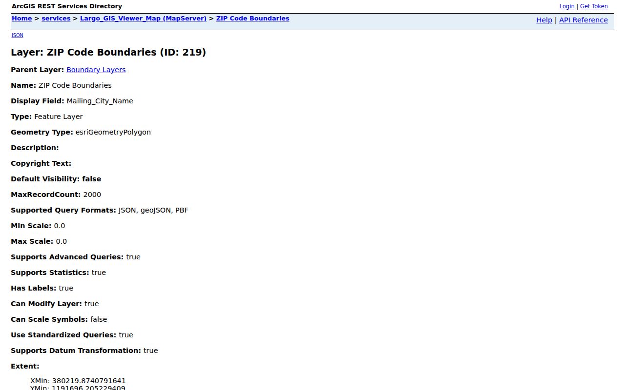
Because the layer is not visible by default, turn it on and compare it with the municipal boundary before choosing a local custodian.
Clearwater ZIPs Inside Largo
ZIPs 33756, 33760, 33762, and 33764 are often presented with Clearwater postal geography, yet each intersects incorporated Largo. This is not an error. The postal city helps route mail, while municipal jurisdiction determines which city provides many local services. Emergency-service communities and map labels may add still more names.
Largo's address schema keeps municipality, postal city, and ZIP in separate fields. The separation matters when looking for permits, code cases, or city records. A Clearwater label on an envelope should not automatically send the search to Clearwater. First establish whether the point lies in Largo, another city, or unincorporated Pinellas County.
Boundary check. A ZIP code is a delivery zone, not a city limit. Verify the full address before selecting Largo or county records.
Search Largo Residents by ZIP
ZIP support differs from portal to portal. Largo GIS exposes address and ZIP layers. Pinellas My Neighborhood accepts a street address, city, and ZIP, then reports municipal status and service providers. The county geocoder accepts a street or intersection, a city or place name, a ZIP, or a single-line address. Its result can supply a match score, side of street, address type, and coordinates. The inspected Property Appraiser Quick Search landing page has no dedicated real-property ZIP mode, while downloadable property data can support ZIP analysis.
- Confirm the deliverable mailing code with the official USPS address lookup. Enter the full street address rather than assuming the city name fixes the code.
- Run the same address through My Neighborhood or the county geocoder. Record the municipal status and service area.
- Overlay the Largo ZIP and city-limit layers. Use address points for known locations and polygons for the broader area.
- Choose the official roll that fits the question. Search property by an address or owner, business filings by ZIP or street, and voter data only through authorized lookup or request channels.
- Once the code is reduced to a named road, continue with the Largo street directory for parcel-level work.
The voter self-lookup is not a ZIP-wide resident browser. Florida's public voter file may support geographic analysis through a proper request, but protected voters and unregistered people will be absent. The Clerk's deed index also works by names, legal descriptions, and book/page, not by ZIP.
Verify a Largo Mailing ZIP
The Postal Service is the authority for whether a full address is deliverable under a given code. Use USPS ZIP Code Lookup before treating a code from an old deed, directory, or form as current. The research found no verified PO-box-only or unique-institution ZIP in the Largo-jurisdiction address query. It also did not establish a current station-by-code inventory. Those gaps should remain gaps.
| Lookup field | What to enter |
|---|---|
| Street address | House number, street name, and unit where applicable |
| City | The mailing city used for delivery |
| State | Florida |
| Result | Standardized address and current ZIP or ZIP+4 |
The USPS form shown here is the right source for address-to-ZIP confirmation.
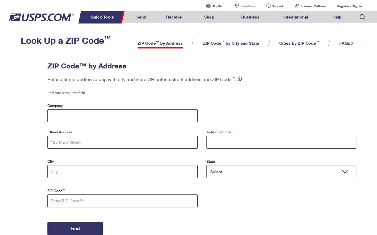
The postal result settles delivery format, but it still does not settle whether Largo governs the location.
Read Largo ZIP Map Layers
The Largo GIS service directory lists ZIP boundaries, address points, city limits, historic limits, police areas, flood layers, and community standards data. Its address layer stores ZIP, postal city, MSAG community, emergency-service fields, parcel components, and municipal jurisdiction. Those fields explain why one location can carry several place labels without contradiction.
The layer catalog shown below is the source map index for a Largo ZIP code directory check.
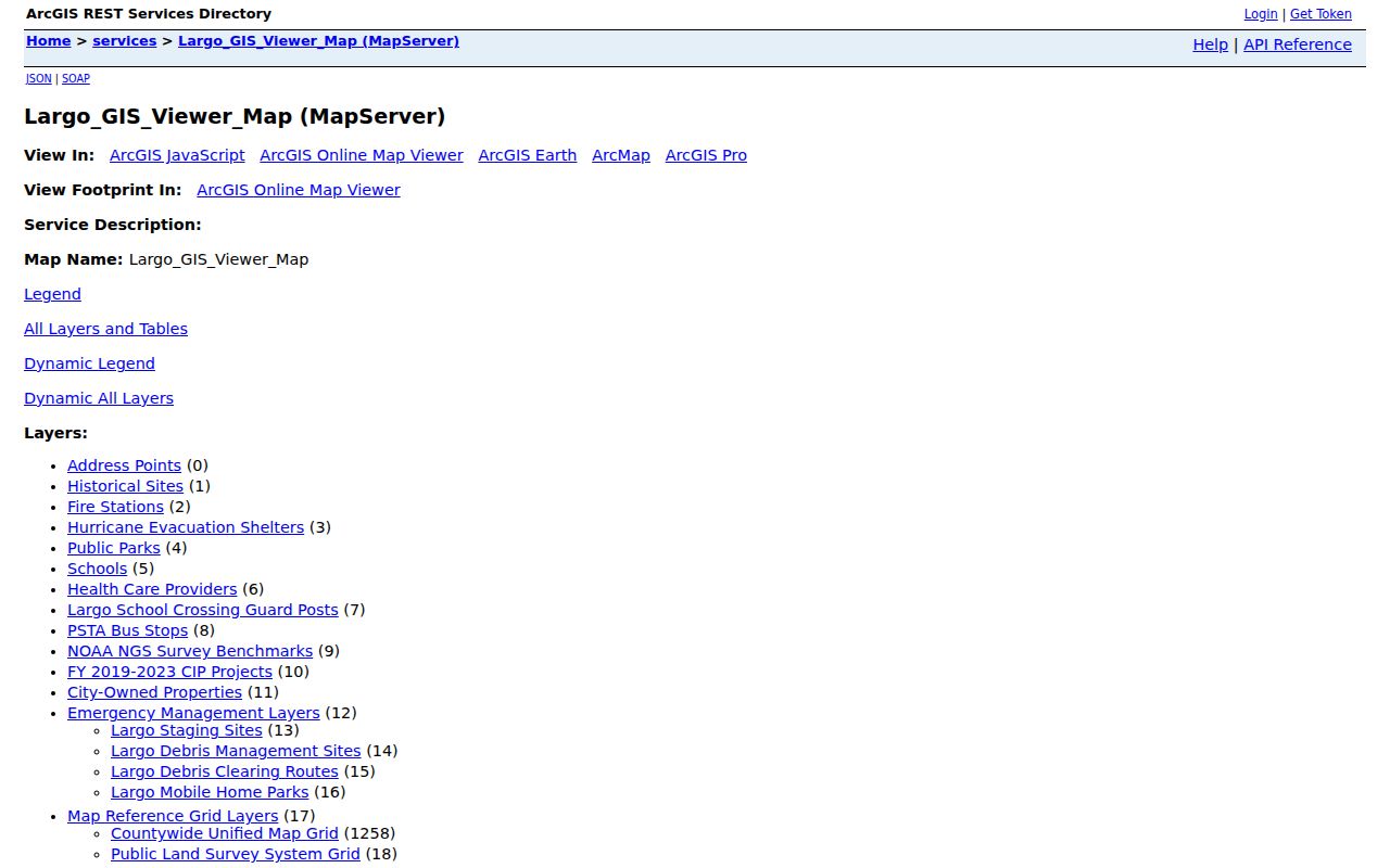
Open the ZIP polygon and city-limit layers together, then use address points to test a specific property rather than relying on the visual edge alone.
The county geocoder adds a second official check. Its inputs include street or intersection, city or place, ZIP, and a single-line address. This makes it useful when a spelling variant or border road prevents a clean match.
The Pinellas geocoder screen exposes the official input and output fields.
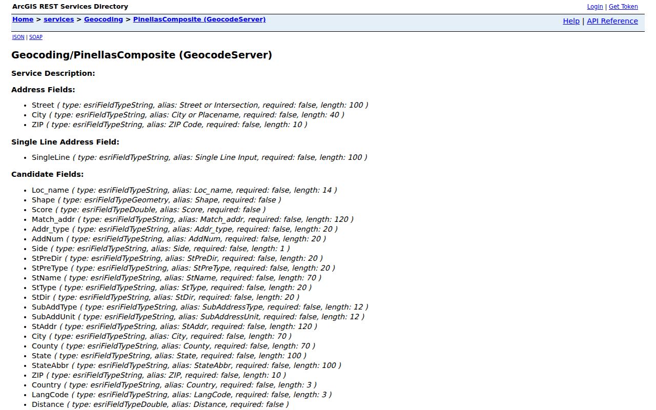
A match score and mapped point help test the address, but the service does not identify every resident there.
Largo Border Roads Split ZIPs
Pinellas road-centerline data stores a ZIP and MSAG community for each side of a road, plus address ranges, road status, and jurisdiction. One side can therefore be in Largo while the other belongs to another city or unincorporated Pinellas County. A street name alone is too broad on these edges. House number and side of street matter.
A local spelling quirk can also affect results. The Property Appraiser uses “Martin Luther King Jr Ave” for incorporated Clearwater, Largo, and Dunedin, but “Dr Martin Luther King Jr Ave” for unincorporated Clearwater and Largo. If the first search fails, reduce the address text or try the jurisdiction-appropriate form. That is more reliable than changing the ZIP at random.
Historic city-limit layers can explain why an older permit or code record sits with a different office. The research did not verify a citywide Largo street-renumbering event, so no such claim belongs in the directory.
Largo ZIP Codes Versus Limits
A complete ZIP code directory keeps four kinds of geography separate. USPS defines postal delivery. Largo and other municipalities define city jurisdiction. Pinellas County GIS maps service and emergency boundaries. Property records identify the parcel and its situs, meaning physical location. When these disagree, each can still be correct for its own purpose.
- ZIP and ZIP+4
- A five-digit delivery area and its more precise four-digit route segment.
- PO-box ZIP
- A code assigned mainly or solely to post office boxes. None was verified for Largo here.
- Unique ZIP
- A code assigned to one high-volume organization. None was verified in the Largo query.
- Carrier route
- A postal delivery path within a ZIP, not a city or neighborhood boundary.
Pinellas My Neighborhood brings the split into one practical result by accepting address, city, and ZIP and returning jurisdiction and service providers.
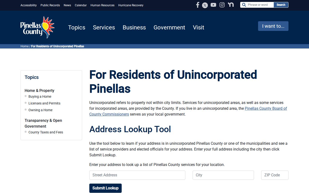
The service result points to the right government office after USPS confirms how the address receives mail.
Note: Count mapped address points as locations, not people; ownership, occupancy, voter registration, and mailing address each answer a different question.