
Walk a Largo Street
A useful street search begins with the Pinellas County Property Appraiser Quick Search. The office recommends using less text: a street name alone can reveal a sequence of matching parcels, while a number plus street narrows the search to one site. The result identifies assessed property and recorded owners. It does not list every person who lives there.
Work from the land outward. Preserve the parcel number and legal description before opening any other system. Those identifiers survive spelling changes and help distinguish two similar addresses. Then follow this Largo street directory sequence:
- Search the street name in Quick Search and export or print the matching parcel rows.
- Open each parcel and confirm its site address, owner mailing address, tax district, use, and legal description.
- Use the map to check adjoining parcels instead of assuming that house numbers define one block.
- Carry each last-deed book and page into the Clerk's official-record index to identify grantors and grantees.
- Check the correct permit system after confirming whether the postal Largo address is actually inside city limits.
The chain is address to parcel, parcel to owner, owner to deed, and deed to earlier owners. Voter material can confirm a lawful, identity-gated registration inquiry, but the public status tool is not a street browser. Old household work belongs in the Largo city directory collections.
Largo Street Directory Fields
Quick Search supports several ways into the same property roll. The address mode is the core of a Largo street directory, while parcel, subdivision, and recorded book/page modes help repair a weak address match.
| Search choice | Entry | Best street use |
|---|---|---|
| Address | Number and street, or street name | One parcel or a run of parcels |
| Owner | Recorded owner or entity | Find other parcels tied to the same name |
| Parcel ID | Formatted parcel identifier | Return to an exact lot |
| Sub/Condo | Subdivision or condominium | Group addresses under one recorded development |
| OR Bk/Pg | Official Records book and page | Bridge deed and parcel data |
Results can show name, distance, parcel number, address, tax district, property use, short legal description, last deed, and map access. Print and export controls support careful street-by-street notes. The Property Appraiser's search guidance also documents local road forms such as County Road, State Road, Alt 19, and US 19.
See the official county address guidance as it appears on the source site:
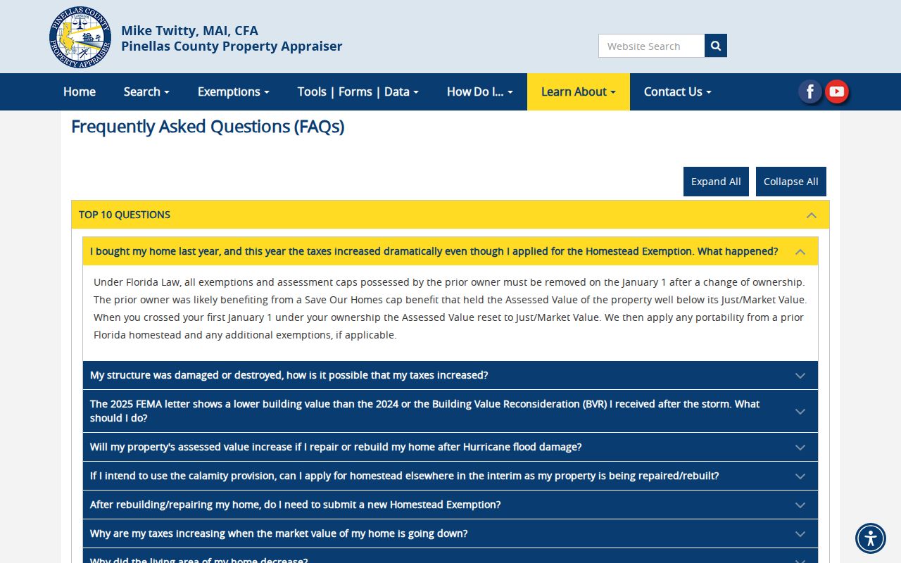
The captured page reinforces why short, normalized address input is often more effective than a full mailing label.
Read Largo Address Roles
A parcel card separates where land sits from where tax mail goes. That difference is central to any search by address. The site or situs address is the physical parcel location. The owner mailing address is the tax-correspondence destination and may be elsewhere. A matching site and mailing address, together with a homestead exemption, can support an owner-occupancy inference. It still does not identify renters, relatives, or a complete household.
- Parcel
- A mapped unit of land with its own identifier and assessment record.
- Situs address
- The physical location of the parcel, also called its site address.
- Plat
- A recorded map that lays out lots, blocks, streets, or a condominium.
- Criss-cross directory
- A historical directory arranged by street and house number rather than only by surname.
The parcel number shown on the public roll is built from section, township, range, subdivision, block, and lot components. The legal description and parcel ID are better bridges than a street label when an address changes. A different mailing address is a lead, not proof that the owner lives elsewhere.
Do not confuse ownership with occupancy. Property, homestead, and matching address fields can support an inference, but they never produce a full resident list.
Map Largo Streets and Parcels
The Largo GIS address-point layer stores far more than a label on a map. Fields include number, unit, full street name, full site address, residential or commercial type, lifecycle and occupancy status, municipality, postal city, ZIP, emergency-service area, parcel components, and coordinates. These fields reveal why a mailing city cannot settle jurisdiction.
The municipal layer set also includes parcels, subdivisions, zoning, flood data, easements, schools, parks, service areas, ZIP boundaries, current city limits, other municipalities, and historic Largo limits. Use geometry to click neighboring lots. Do not infer adjacency from number order alone. One numbered run can cross a subdivision or city boundary.
Inspect the official Largo address-point service and its published schema here:
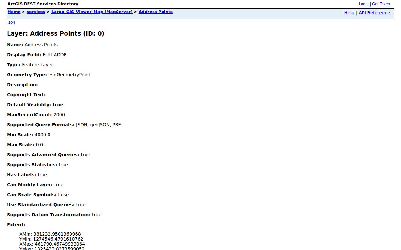
The field inventory makes the separate municipal, postal, ZIP, road, and parcel roles visible.
Pinellas road-centerline data adds left and right ZIP, community, emergency-service, municipality, address range, road status, and jurisdiction. One side of a border road can therefore differ from the other. That is a map question, not a household question.
Largo Records Indexed by Address
No single source is the Largo street directory. A reliable review joins several address-linked systems and respects what each one can prove.
| Largo address source | Official keeper | What it establishes | Access path |
|---|---|---|---|
| Property roll | Pinellas Property Appraiser | Owner, site and mailing address, parcel, use, sale bridge | Free Quick Search, map, office help |
| GIS layers | Largo and Pinellas GIS | Address geometry, parcels, boundaries, ZIP and districts | Free map and REST layers |
| Official records | Pinellas Clerk | Deeds, mortgages, liens, plats, declarations | Online index, terminals, microfilm, branches |
| Permits | Largo or Pinellas, by jurisdiction | Applications, inspections, contractors, work history | LCAP or county Access Portal |
| Voter records | Pinellas Supervisor of Elections | Registration and precinct data within legal limits | Identity-gated lookup or records request |
The Property Appraiser has a Mid County office at 13025 Starkey Road in Largo, open weekdays from 8 a.m. to 5 p.m., with help at 727-464-3207. That in-city fallback matters when an online match fails. Official-record gaps can be handled at Clerk public terminals and record rooms in Clearwater or St. Petersburg.
Follow Largo Parcels into Deeds
A parcel's sales history names grantors and grantees and supplies the recorded book and page. A grantor transferred the interest; a grantee received it. Open the Pinellas Official Records search and compare the legal description, not just the name. The portal supports party name, instrument number, document type, date, consideration, book/page, case number, and legal-description searches.
Online coverage has firm limits. Pinellas official records begin with county creation in 1912. The web and office index begins in 1957, while legally viewable images are online from 1970 forward. Earlier work calls for Clerk terminals, microfilm, or images at the Clearwater Official Records Room and St. Petersburg branch. Pre-1912 Largo land may fall in Hillsborough County records.
Once a deed opens, save its parties, recording date, instrument reference, book/page, and exact land description. Search the seller as an earlier buyer, then repeat. The address can change while the legal land identity stays useful.
Note: An online-only Largo street directory will miss deed evidence outside the 1957 index and 1970 image windows.
Choose Largo Permit Jurisdiction
Postal Largo and incorporated Largo are not the same footprint. Use Pinellas My Neighborhood with street address, city, and ZIP before choosing a permit custodian. Incorporated addresses use Largo's LCAP system. Postal Largo outside city limits may use the Pinellas Access Portal or another municipality.
LCAP can connect an address with permits, plans, inspections, code cases, business tax receipts, and registrations. These names reflect an application, contractor role, business tie, or property work. They do not prove current ownership or residence.
The Largo permit interface appears in this captured source:
The screen belongs in the address workflow only after jurisdiction has been checked.
For the county route, Pinellas Access Portal instructions allow permit, license, address, and parcel queries without an account. Some actions still require one. The county interface is shown below.
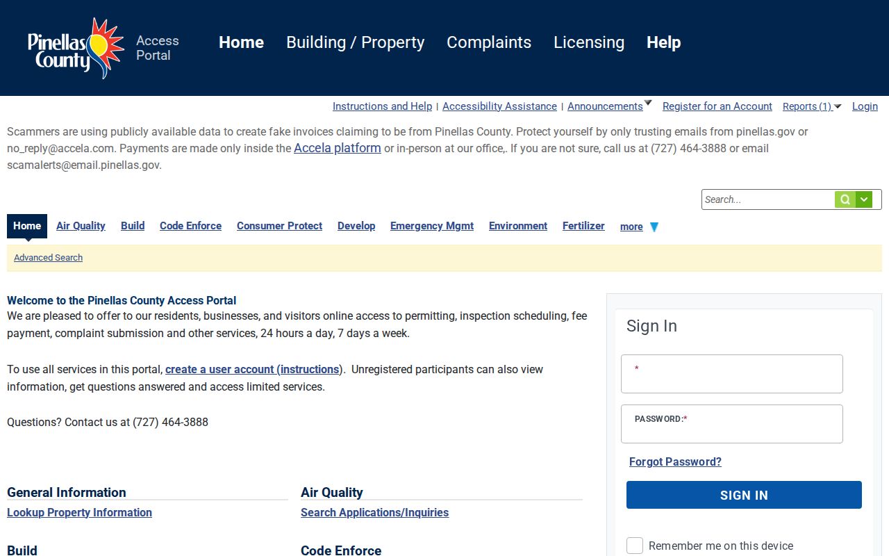
This portal applies only after the jurisdiction check points away from incorporated Largo. County Accela also warns that scammers reuse real permit details in fake invoices. Verify any demand through the government portal or at 727-464-3888.
Largo Street Names Need Context
Local search spelling changes at jurisdiction lines. The Property Appraiser uses “Martin Luther King Jr Ave” for incorporated Clearwater, Largo, and Dunedin, but “Dr Martin Luther King Jr Ave” for unincorporated Clearwater and Largo. Search both forms when a road crosses the edge.
Pinellas centerline data documents each road's full name, side-specific ZIP, community, emergency-service number, municipality, range, status, and jurisdiction:
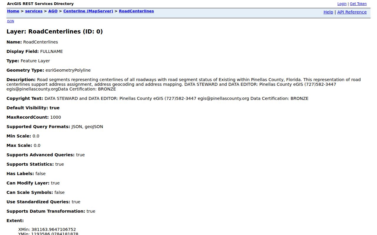
Those side-specific fields explain why two properties facing one another may route to different records offices.
Largo GIS preserves historic municipal limits for 1974, 1983, and annual snapshots from 1995 through 2014. Annexation can change which office holds permits or code history. No authoritative citywide renumbering event was confirmed, so do not force a street-renumbering story onto a weak match. Use parcel ID, subdivision, block, lot, and legal description instead.
Place Old Largo Households
Modern parcel and permit records should not be stretched into an old household roll. The confirmed 1912 regional directory explicitly names St. Petersburg, Clearwater, Largo, and Tarpon Springs. It can place a listed person at an address, and the 1910 Largo census extraction can provide a nearby comparison. The historical collection itself, its surname indexes, and its careful use are covered on the city directory page.
A criss-cross section, when a verified volume has one, reverses the usual name search and lists entries by address. The research did not confirm a complete later Largo criss-cross run, so exact years require a Largo Genealogy Center catalog or title-page check. That gap is important. A street directory must not imply that every road, renter, or year appears in print.
Note: Search “Anona” as an earlier locality term when Largo does not appear in an old index.
Largo Street Directory Limits
Property records identify assessed owners, not every occupant. A deed records an interest in land. Permit files record work and applicants. GIS fixes geography. None provides a current list of renters, children, guests, utility customers, or all people sharing an address. Driver residence information is restricted by federal law, protected addresses can be withheld, and the public voter lookup is not an open block roll.
Use address records for family history, title work, civic research, reconnecting, and personal safety. Confirm a claim at the office that holds the source. An omitted record can reflect a date cutoff, different jurisdiction, spelling form, sealed file, or lawful confidentiality rather than absence.
Lawful use. Largo address records must never be used to stalk, harass, intimidate, or defeat protected-address rules.
A commercial compilation may merge stale sources and same-name people without showing how to correct them. Official custodians retain the clearer audit trail. For a failed portal, send a focused request under Florida Public Records Law to the known custodian, naming the address, record series, and date range.